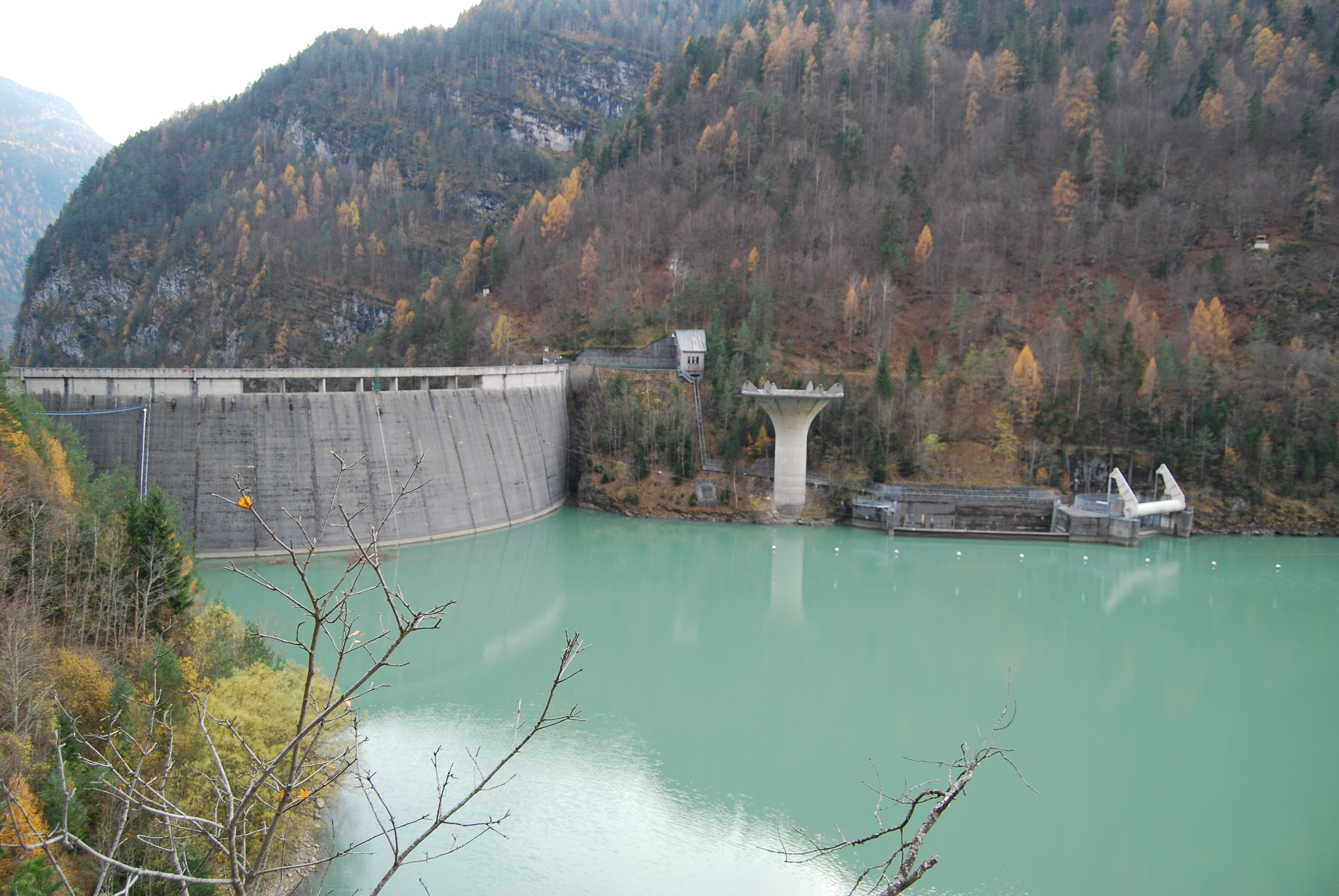
The Po Basin's flood control infrastructure extends well beyond its main-channel levees. A distributed network of dams, weirs, lateral retention basins, and engineered overflow corridors operates across the principal tributaries in Piedmont, Lombardy, Veneto, and Emilia-Romagna. These structures serve different functions depending on their position in the catchment: upstream reservoirs can reduce peak discharges by temporarily storing runoff; midstream weirs regulate minimum flows for irrigation and navigation; and lowland retention areas absorb excess discharge that the main channel cannot contain without levee overtopping.
Upstream Reservoirs and Alpine Dams
Several large reservoirs in the Alpine and pre-Alpine zone contribute incidentally to flood attenuation, though their primary purpose is hydroelectric power generation or water supply. The Lago Maggiore (Verbano) and Lake Como (Lario) act as natural buffers for the Ticino and Adda rivers respectively. Their very large volumes relative to tributary inflows mean that extreme rainfall events in their catchments result in slower and lower discharge peaks than would occur on an unregulated river.
This buffering capacity is not unlimited. In November 2014, for example, Lake Como reached levels close to its banks in Bellagio and Como city, demonstrating that even large pre-Alpine lakes can be overwhelmed by extended precipitation combined with pre-existing high water levels. Lake regulation plans, maintained by regional agencies and the Interregional Lake Observatory (OISTBI for Lake Maggiore), specify drawdown targets before forecast heavy rainfall to increase available buffer capacity.
The Pontesei Dam and the 1966 Event
The Pontesei dam on the Maè torrent in the Zoldo valley (Belluno province, Veneto) illustrates the relationship between hydraulic structures and catastrophic events. Built in the 1950s as part of an expansion of alpine hydroelectric capacity, its reservoir was nearly full when the November 1966 floods — which also caused the catastrophic Arno flood in Florence — struck the Dolomite foothills. Emergency procedures were activated to manage reservoir levels during the event. The dam itself held, but the 1966 flood became a watershed moment in Italian hydraulic engineering, prompting a comprehensive review of dam safety, emergency spillway design, and downstream flood routing for the Venetian plain.
Lowland Weirs and Flow Regulation
Weirs on the Po's lowland tributaries — structures that maintain a minimum water surface elevation rather than store large volumes — are primarily associated with irrigation networks that have served the Padana Plain since medieval times. The historic Bonifica Bentivoglio drainage system in Emilia-Romagna and the extensive Po Valley irrigation consortia in Lombardy both depend on weirs to maintain the head needed for canal offtakes.
During flood events, these weirs can become hydraulic bottlenecks, temporarily increasing upstream flood levels if they are not equipped with movable gates. Progressive modernisation of fixed-crest weirs with radial or flap gates — allowing controlled lowering during flood conditions — has been a component of infrastructure renewal programmes in several provinces.
Types of Flood-Control Structures in the Po Basin
- Alpine reservoirsPassive attenuation via storage volume
- Pre-Alpine lakesNatural buffers; regulated via lake outlets
- Flood retention basinsControlled inundation of designated lowland areas
- Movable weirsFlow regulation; lowered during flood events
- Emergency overflow corridorsDesigned overflow routes to protect urban areas
- Pumping stationsDrainage of flat lowland areas behind levees
Retention Basins: Design and Locations
Dedicated flood retention basins — areas specifically engineered to receive controlled overflow from a river channel during high-water events — represent a relatively newer component of Po Basin infrastructure. Unlike traditional levee systems, which attempt to confine the river entirely, retention basins work by deliberately allowing defined quantities of water to spread over designated land, thereby reducing the flood peak that continues downstream.
The Parma retention basin, proposed and partially implemented following the 2000 Po flood, is one of the better-documented examples in Emilia-Romagna. The concept involves a laterally adjacent depression that receives water through a controlled breach in the main levee when river discharge exceeds a threshold. The basin is largely agricultural land; compensation schemes for farmers are integral to the governance model.
Pumping Infrastructure in the Lowland Plain
Much of the Padana Plain below sea level — particularly in the Po delta region and the reclaimed areas of Ferrara and Rovigo provinces — cannot drain naturally to the river during high-water events. This land, known as bonifiche idrauliche (hydraulically reclaimed land), is kept dry by an extensive network of pumping stations that lift drainage water over the levees into the main channel or its tributaries. During flood events, when river levels are high, these pumping stations must work continuously to prevent internal waterlogging on the landward side of the embankments.
The Consorzio di Bonifica Delta del Po and similar consortia in the lower Po plain operate hundreds of pumping stations, some dating to the early 20th century though progressively electrified and modernised. Power supply security for these stations during flood emergencies is a recognised vulnerability, and emergency generator protocols are specified in regional civil protection plans.
Infrastructure Renewal and EU Funding
A significant portion of hydraulic infrastructure renewal in Northern Italy has been funded through EU cohesion funds and the national PNRR (Piano Nazionale di Ripresa e Resilienza), with projects overseen by the Ministry of Environment and Energy Security (MASE). Priority investments include replacing obsolete pumping equipment, reinforcing embankments at identified critical cross-sections, and completing hydrometric monitoring stations on poorly instrumented tributaries. Project databases are publicly accessible through the AdbPo and MASE portals.